World-renowned photographer Virginia Beahan's striking images celebrate the beauty of Louisiana’s disappearing wetlands and bayous and spotlights how they are worth protecting and restoring for future generations.
Artist Statement
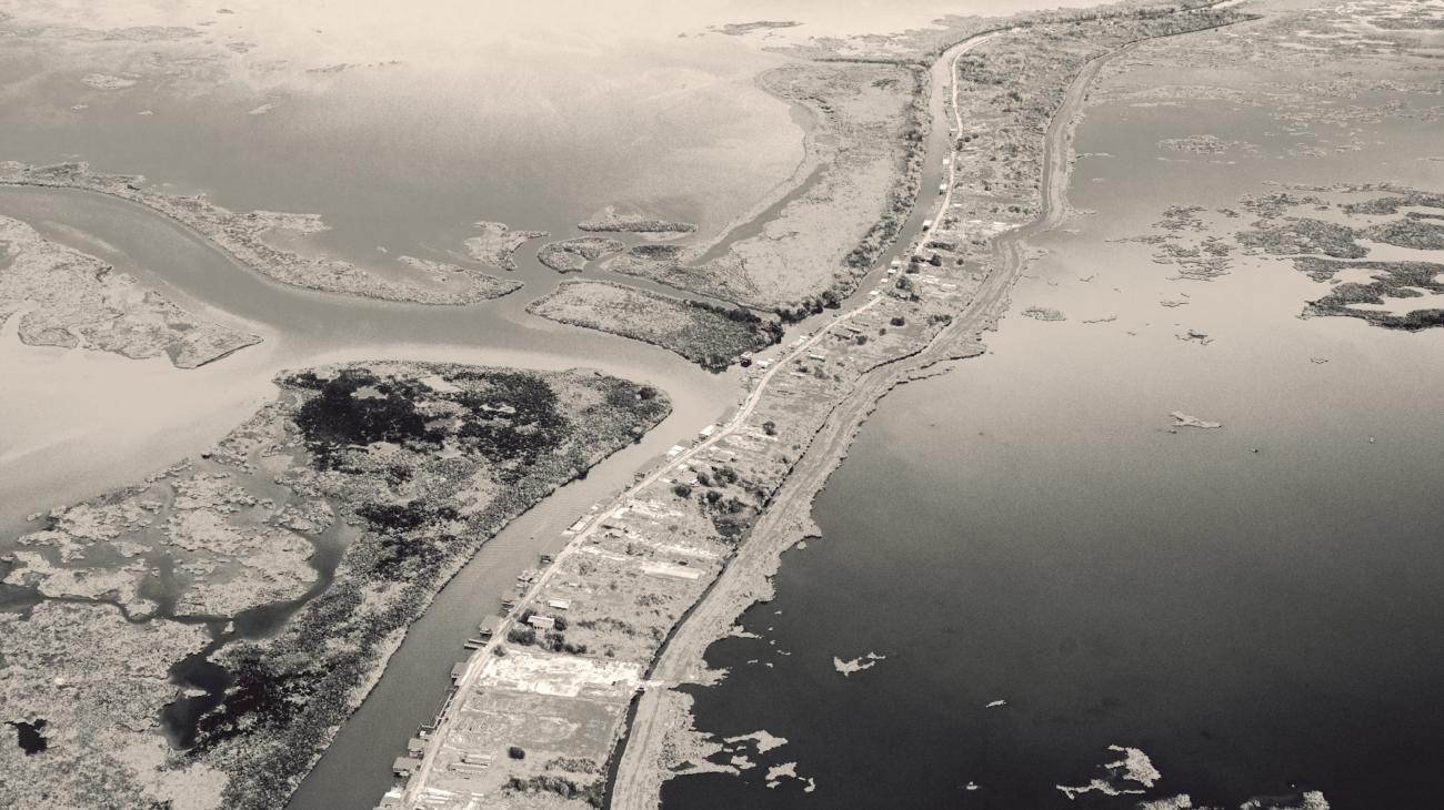
The view from the window of my first commercial flight into New Orleans was of a striking monochromatic landscape below. In the raking light, I recognized the disappearing wetlands and bayous of southeastern Louisiana and the intricate patterns of human intervention within their complex and fragile ecosystems.
Hurricanes, saltwater intrusion, and sea level rise, combined with the building of levees and flood control barriers along the Mississippi River, have upset the balance between land accretion and erosion in this coastal region. Dredging for pipelines and canals by the fossil fuel industry further contributes to habitat and wetland disruption.
These profound changes adversely affect the lives and economies of the people who live there and have spawned dozens of mitigation efforts involving sediment diversion, reforestation, and other coastal resilience programs.
My aerial images are intended to function as a kind of personal mapmaking, visual representations of a place in time: the palpability of atmosphere and weather, the grit and shape of rock, soil and tree, the breath of wind across the water. These photographs celebrate the beauty of the land and environments worth protecting and restoring for future generations.
Why maps? My father, an excellent observer of both sea and sky, used to say, “Navigation is very important—you always need to know where you are on the planet.” But maps also serve as metaphors for our endeavor to locate ourselves, conceptually as well as physically. What this is about, I think, is the power of the imagination and its ability to create meaning and connection.
—Virginia Beahan, September 2025